
Computation and Visualization in the Earth Sciences
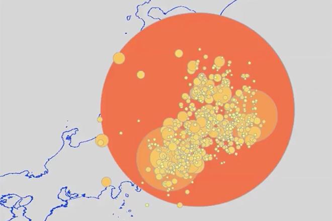
Credit: Earthquake locations from USGS by E Richardson © Penn State University licensed under CC BY-NC-SA 4.0
Resource Description
In EARTH 801, you will develop skills in a programming language designed for visual arts and visualization while exploring Earth science topics. Specifically, you'll learn and practice digital graphics capabilities in order to render Earth science concepts that are otherwise difficult to visualize due to complicated space and time scales. Here, you will interact with large, open, freely-available data sets by collecting, plotting, and analyzing them using a variety of computational methods. You'll be ready to teach secondary school students a range of Next Generation Science Standard skills involving data collecting, manipulation, analysis, and plotting. You'll also read and discuss current research regarding the teaching, learning, and evaluation of visualization skills, as well as multiple external representations of science concepts. Learn moreMaking Maps that Matter with GIS
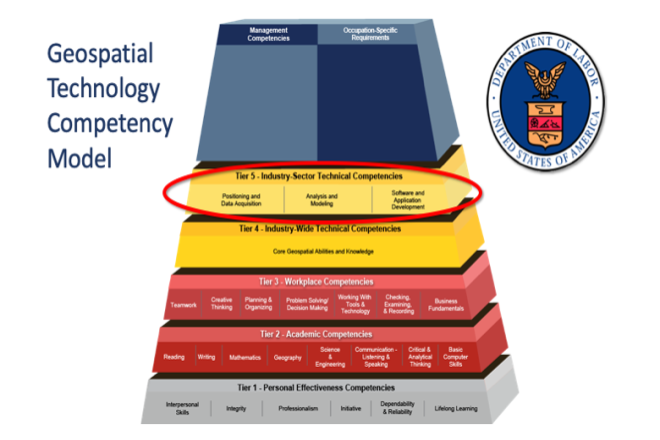
Credit: US Department of Labor Employment & Training Administration - Used with Permission
Resource Description
This open courseware consists of eight videos from the gateway course to Penn State's Certificate and Masters degree programs in GIS. Following an introduction entitled “Why GIS Matters," six case studies correspond to the three sectors of the U.S. Department of Labor’s Geospatial Technology Industry: 1. Positioning and Data Acquisition (“GIS and the Eradication of Polio in Nigeria” and "A Global Geodetic Reference Frame for Sustainable Development”) 2. Analysis and Modeling (“Everyday Spatial Analysis” and “A National Water Model for Flood Prediction and Response”) 3. Software and App Development (“Rediscovering GIS” and “Building a Web GIS Business) The concluding video "Will GIS Matter in the Internet of Things?” considers the future of GIS technology and prospects for GIS people. Making Maps that Matter with GIS Video Playlist Learn moreMaps and the Geospatial Revolution
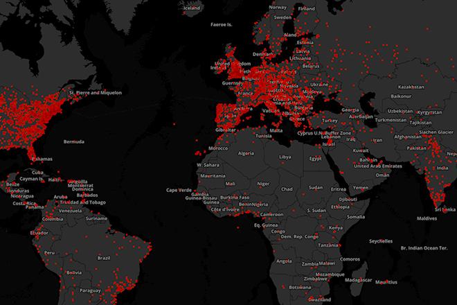
Credit: A. Robinson © Penn State University is licensed under CC BY-NC-SA 4.0