
Geospatial System Analysis and Design
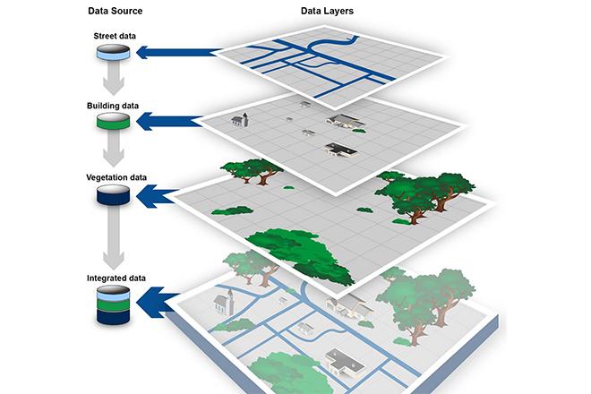
Credit: GEOSPATIAL DATA: Progress Needed on Identifying Expenditures, Building and Utilizing a Data Infrastructure, and Reducing Duplicative Efforts, from the U.S. GAO report, 2015 is Public Domain
Credit: GEOSPATIAL DATA: Progress Needed on Identifying Expenditures, Building and Utilizing a Data Infrastructure, and Reducing Duplicative Efforts, from the U.S. GAO report, 2015 is Public Domain